
Cartersville ZIP Directory Areas
Two USPS city-name ZIPs commonly serve Cartersville. One gives a downtown and west-south orientation. The other points broadly toward north and east Cartersville and the I-75 corridor. These descriptions organize a search, but they are not surveyed lines. Verify an exact address with USPS and check municipal status through Bartow parcel geography.
| ZIP Code | Areas Covered | Post Office | Notes |
|---|---|---|---|
| 30120 | Downtown and much of west/south Cartersville | USPS city/address lookup | Postal coverage does not prove city jurisdiction |
| 30121 | North/east Cartersville and I-75 corridor | USPS city/address lookup | Postal Cartersville may extend beyond city limits |
No official source reviewed identified a separate PO-box-only code, unique institutional code, split year, or recent realignment for Cartersville. This postal directory does not fill those gaps with unofficial claims.
Verify Cartersville ZIP Addresses
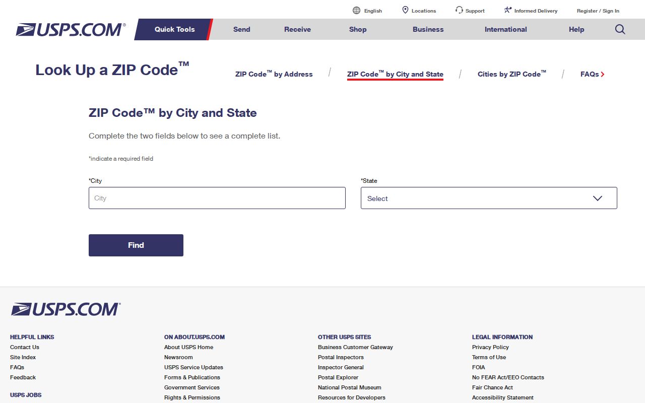
The USPS ZIP Code Lookup is the official first check. City-and-state mode identifies ZIP codes associated with Cartersville. Address mode is better when the house number and street are known. Its result confirms mail routing, not parcel ownership, tax district, voting district, or city services.
| USPS field | Use | Result |
|---|---|---|
| Street address | Exact address mode | Standard address and ZIP |
| City | City-and-state mode | Enter Cartersville |
| State | City-and-state mode | Select Georgia |
| Find / Clear | Form controls | Run or reset the search |
The official lookup shown here illustrates why postal verification comes before a records search.
30120 Cartersville Directory
Use 30120 as an orientation for downtown and much of west and south Cartersville. Older downtown research may also need deeds, plats, directories, and the May 1895 Sanborn sheets. A current postal code cannot explain an old street label or building footprint.
When the address appears in qPublic, record its situs address, parcel ID, legal description, and tax district. Situs means the physical location assigned to the taxed parcel. If the goal shifts to a named road, the Cartersville street directory gives the address-by-address method.
Note: A 30120 mailing line narrows a search, but parcel and city records establish jurisdiction.
30121 Cartersville Records
The 30121 delivery area broadly covers north and east Cartersville and the I-75 corridor. Growth and annexation make the postal-versus-city distinction important. Cartersville covered 28.62 square miles in 2020 Census geography, yet a ZIP route can cross a municipal line without changing the postal city name.
Start with USPS. Next use the Bartow qPublic property search and its map. Tax district and mapped position are stronger evidence of incorporation than a 30121 label. Refer an unclear line to Cartersville Planning or Bartow GIS.
Search Cartersville Residents by ZIP
No verified official portal offers a public ZIP-wide people search for Cartersville. qPublic has confirmed owner-name, location-address, parcel-number, and legal-description fields, but no verified ZIP filter. My Voter Page is an identity-gated self-lookup, not a public ZIP browser. Work from verified addresses.
- Run the exact address through USPS and note its standardized form and ZIP.
- Search that address in qPublic. Record parcel ID, situs, owner, and legal description.
- Open the parcel map to check position, road, adjacent land, and tax district information shown live.
- Use My Voter Page only for one's own registration, or obtain the lawful official file suited to the question.
- Date each result because ownership, registration, boundaries, and delivery routes change.
A municipal Cartersville voter list cost $65 and a Bartow County list $70 in the July 2024 schedule. Orders are normally emailed in about two weeks, prepaid, and not expedited. Registration evidence is not a live census of every person in a ZIP.
Cartersville ZIP Address Types
Three address forms can appear in one inquiry. A postal result serves mail delivery, the assessor's situs address locates taxed land, and the deed's legal description identifies conveyed land. An owner's tax mailing address may be somewhere else.
- ZIP code
- A five-digit USPS delivery-area code, not a city boundary.
- ZIP+4
- Four added digits that narrow delivery to a smaller segment.
- PO-box ZIP
- A code mainly for post-office boxes; no separate Cartersville one was verified.
- Unique ZIP
- A code for one high-volume institution; no local example was verified.
- Carrier route
- A mail route within a ZIP, not a parcel or voting district.
Parcel ID is the stable bridge between qPublic and GIS. Legal descriptions may use subdivision, lot and block terms, or metes and bounds. They matter when street labels change.
Cartersville ZIP Record Fallbacks
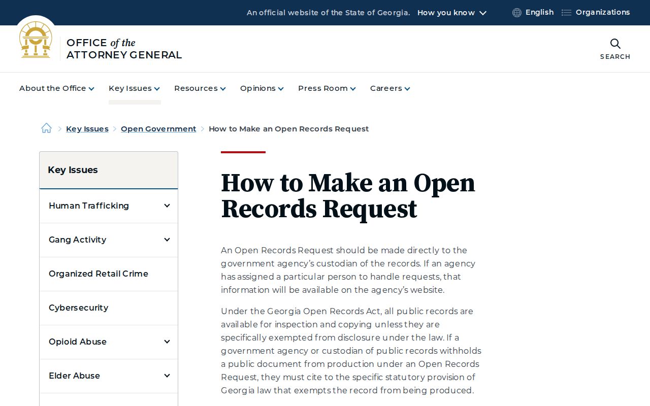
If a portal cannot filter by ZIP code, ask for an existing record rather than a new custom list. Georgia law does not require an agency to create a compilation it does not keep. A sound request names exact addresses or parcels, the record type, and a date range.
General city requests can go to orr@cityofcartersville.org, the City Clerk at 10 N. Public Square, second floor, or PO Box 1390, Cartersville, GA 30120. The ordinary response window is three business days. Lawful search, retrieval, redaction, and copy costs may apply.
Georgia's open-records instructions explain this fallback.
Date Cartersville ZIP Evidence
A ZIP result should be saved with the date searched and the full standardized address. Parcel ownership, voter registration, and permit records also need their own dates. They are updated on different schedules, so a matching number in several systems does not mean every record describes the same day.
Cartersville's 2020-2024 Census estimates counted 9,230 households, with 2.52 people per household and a 59.2 percent owner-occupied rate. Those figures explain a core limit of any property-based postal directory: the assessor represents owners well, but it cannot enumerate all non-owner occupants or household members. The estimate that 88.2 percent of residents age one and older lived in the same house one year earlier is also aggregate context, never proof about one person.
Use source dates as labels. Write “USPS result checked,” “qPublic roll viewed,” and “voter file ordered” with separate dates. If a name or address differs, investigate the timing before assuming an error. A deed may record a transfer before the assessor updates, and a postal route can remain stable while land is annexed.
Official sources also have different legal roles. USPS controls delivery information. Bartow Assessors maintain the valuation roll, GIS supplies parcel geography, the Superior Court Clerk certifies deeds, and Cartersville keeps municipal permit records. A sound Cartersville ZIP code search preserves those lines instead of blending the records into one undated resident profile.
Cartersville ZIPs Versus City Limits
A Cartersville name on mail can extend beyond incorporated Cartersville. USPS sorts delivery. The city and county govern land, voting, courts, permits, and services through other lines. The mismatch is normal.
Confirm city status before asking for permits. Use the Bartow assessor and GIS for parcels, the proper election channel for voting data, and the Superior Court Clerk for deeds. Each office answers a different question.
Boundary check. Treat 30120 and 30121 as delivery orientation only; verify each address, then confirm city status on the parcel map.
Cartersville's 2025 population estimate was 25,349, up 9.5 percent from the 2020 estimate base. Growth makes dates vital. Never project a current ZIP directory backward without a dated map, plat, deed, or directory.